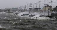
Tropical storm “Freddy” that is expected to land in the days ahead will have limited impact on most parts of the country while parts of Mpumalanga and Limpopo can expect heavy rain.
“The only province where there is a significant risk of direct impact, in terms of heavy rain, flooding and/or wind damage, is for the very eastern districts of Limpopo province, in particular, Vhembe as well as Mopani,” the South African Weather Service (SAWS) said on Friday.
These districts, including the northern half of the Kruger National Park (KNP) will be on the edge or periphery of the heavy rain area.
“Consequently, the SAWS is issuing a Level 5 (five) Orange warning, in terms of SAWS Impact-Based Warnings system for the easternmost sections of Vhembe and Mopani respectively. This level of warning is associated with a moderate likelihood of significant impacts.
“The remainder of the lowveld regions of Limpopo and Mpumalanga, as well as the Escarpment region of Limpopo are included in a low-level warning, namely a Level 2 Yellow warning for heavy rain and/or localised flooding.
“The high levels of uncertainty surrounding the movement and intensity of such tropical systems, especially when they move overland, remain a challenge for forecasters worldwide. Hence the public can rest assured that SAWS, in consultation with National and Provincial Disaster Management structures, will continue to closely monitor developments on a 24/7 basis and will issue regular updates in this regard, across a variety of media and social media platforms,” the weather service said.
For the past two days, “Freddy” has moved briskly westward, across the southern part of the Mozambique Channel, towards the coastline of Mozambique.
“As expected, “Freddy” has steadily intensified throughout this period, drawing energy from the very warm ocean surface.
“At the time of writing, this system will imminently be making landfall on the Mozambican coast, between the towns of Vilankulos and Maxixe. Sustained winds in association with the vortex, or “eye” of the system are of the order of 89 to 118 km/h, hence there is a high likelihood of wind damage to the built environment along the coast and adjacent interior as “Freddy” makes landfall.
“Moreover, there is a high risk of windblown debris, such as corrugated iron sheeting, causing serious injury to humans and livestock,” SAWS said.
Despite “Freddy” arriving on the Mozambican coast as a Severe Tropical Storm, this system is widely expected to begin weakening and decaying overland during the weekend, as it begins to dominate the atmospheric circulation of southern Mozambique, just eastwards of the Lowveld region of South Africa.
“Residents of southern Mozambique are therefore urged to be acutely aware that a spell of torrential tropical rainfall and sustained windiness is likely to affect a significant part of southern Mozambique during the latter half of Friday and extending throughout the coming weekend.
“Moreover, major rivers in southern Mozambique will soon be in flood, further exacerbating the situation. Communities living along the banks of these regions should therefore evacuate to higher ground at an early stage,” SAWS said.
The public is urged and encouraged to regularly follow weather forecasts on television and radio.
Updated information in this regard will regularly be available at www.weathersa.co.za as well as via the SA Weather Service Twitter account @SAWeatherService. –SAnews.gov.za


